Stellarium

Media reports from the scientific and natural world, not specifically about dowsing.
User avatar
Grahame
Site Admin
Site Admin
Proficient
Proficient
Posts: 1473
Joined: Wed Jul 28, 2004 5:52 pm
Location: Glasgow, Scotland
Contact:

Re: Stellarium

Post by Grahame »

Sorry Rory, Ian clearly couldn't wait, he's gone and done it himself (with a little help from me):

Image

Avebury North Circle is available on the Stellarium landscapes page, and very fine it is too.
Last edited by Grahame on Tue Jun 30, 2020 7:34 pm, edited 1 time in total.
Reason: updated link
Grahame
The trouble with having an open mind, of course, is that people will insist on coming along and trying to put things in it - Terry Pratchett.
User avatar
Grahame
Site Admin
Site Admin
Proficient
Proficient
Posts: 1473
Joined: Wed Jul 28, 2004 5:52 pm
Location: Glasgow, Scotland
Contact:

Re: Stellarium

Post by Grahame »

Stellarium 0.10.3 is out! There are some great new features and improved keyboard interface. The main change is the addition of plug-ins, for instance there is one that downloads and displays positions of satellites, another that allows angular calculations, or one that displays compass bearings along the horizon line, which is a great one for checking the accuracy of your landscapes.... :cry:
Grahame
The trouble with having an open mind, of course, is that people will insist on coming along and trying to put things in it - Terry Pratchett.
Ian Pegler
Expert
Expert
Posts: 2824
Joined: Fri Sep 17, 2004 12:04 pm
Location: Borth, Mid Wales

Re: Stellarium

Post by Ian Pegler »

Grahame Gardner wrote:Stellarium 0.10.3 ...which is a great one for checking the accuracy of your landscapes.... :cry:
Why so sad? Surely that's a good thing?

How does it compare to 0.10.2 in terms of speed and stability? If I download this, will it crash my graphics card?

Ian
User avatar
Grahame
Site Admin
Site Admin
Proficient
Proficient
Posts: 1473
Joined: Wed Jul 28, 2004 5:52 pm
Location: Glasgow, Scotland
Contact:

Re: Stellarium

Post by Grahame »

Ian Pegler wrote:Why so sad? Surely that's a good thing?
Says he with his GPS-aligned landscapes.... :mrgreen:
I suspect it will show up the minor flaws in my ones, which were only aligned 'by eye'. But not any more, since I got my GPS at Xmas!

Speed and stability - I've only just downloaded it on my Vista laptop, and it seems fine, even with the plugins activated. But I haven't had a chance to play with it much yet. Maybe tomorrow.
Grahame
The trouble with having an open mind, of course, is that people will insist on coming along and trying to put things in it - Terry Pratchett.
Ian Pegler
Expert
Expert
Posts: 2824
Joined: Fri Sep 17, 2004 12:04 pm
Location: Borth, Mid Wales

Re: Stellarium

Post by Ian Pegler »

Grahame Gardner wrote:Says he with his GPS-aligned landscapes.... :mrgreen:
Bwa ha ha ha... :twisted: :mrgreen:

I've downloaded it and had a play. It seems pretty stable, even on my old PC. The new angle and compass plug-ins are just so useful!

The main problem with the landscapes is that the image itself is not going to be perfect, there's going to be distortions because of the camera-lens or the way your photo-stitching software puts everything together. So even if you've got GPS-derived azimuth-angles for distant landscape features, the chances are not all of them will align perfectly; so there's always an element of compromise. Even so, it's a lot better than aligning by eye or using a compass. The best thing to do is to get the "business-end" of the stone circle aligned as best you can. By the "business end" I mean whatever feature interests you the most. I guess that for most people this will be the easterly quadrant where the Sun rises.

It would be nice to be able to realign the landscape from within Stellarium itself, by dragging and dropping.

Ian
Ian Pegler
Expert
Expert
Posts: 2824
Joined: Fri Sep 17, 2004 12:04 pm
Location: Borth, Mid Wales

Re: Stellarium

Post by Ian Pegler »

Grahame Gardner wrote:Supplemental - I just installed the Woodhenge landscape and was rather astonished to find what looks like a dowser with L-rods in the picture!

Image

How cool is that? :mrgreen:
As readers of Dowsing Today will now know, this is actually not a dowser, it's Tom Flowers. For more information see:

http://www.DefinitiveStonehenge.com (link broken)

Ian
Ian Pegler
Expert
Expert
Posts: 2824
Joined: Fri Sep 17, 2004 12:04 pm
Location: Borth, Mid Wales

Re: Stellarium

Post by Ian Pegler »

You don't need to shunt the graphics of your landscape around to make East appear on the left-side; there's a simpler way of doing it (saves a lot of trial and error).

CLICK HERE for more on Landscape rotation.(link broken)

A worked example:

The landscape.ini file for my Avebury North Circle landscape looks like this:
[landscape]

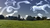
name = Avebury North Circle
author = Ian Pegler
description = The North Circle at the massive megalithic site of Avebury, England.
type = spherical
maptex = AveburyNorth.png
angle_rotatez = 215.67

[location]

planet = Earth
latitude = +51d25'45"
longitude = -1d51'14"
altitude = 162
The key here is to discover the correct value for angle_rotatez. Once you have have this in your .ini file you're done.

The orientation of my Avebury image was calculated by taking two GPS waypoints whilst at the site: one at the centre and one in the distance by a recognizable feature, in this case a distant stone. Some PC based software such as EasyGPS or Garmin Trip and Waypoint Manager (see previous posts) can then be used to give you the bearing from True North of your distant object (the stone in this case). This is the value for b:

b = 71 degrees

Now open the landscape-graphic with an image editor and hover the mouse-pointer over where the distant object is. Somewhere you should be able to read off the x coordinate.

x = 713

The value of large X will be the width in pixels of your landscape-graphic, which will be a power of two.

X = 2048

Then plug the numbers into the equation 270 + b - (360 * x / X)
where * indicates 'multiply' and / indicates divide.

270 + 71 - (360 * 713 / 2048) = 215.67

Since this is within the range (zero or more, but less than 360), this is the final value for angle_rotatez = 215.67 which you then put into your landscape.ini file.

Ian
Last edited by Grahame on Tue Jun 30, 2020 7:38 pm, edited 1 time in total.
Reason: updated links
Ian Pegler
Expert
Expert
Posts: 2824
Joined: Fri Sep 17, 2004 12:04 pm
Location: Borth, Mid Wales

Re: Stellarium

Post by Ian Pegler »

One possible use of the Angle measurement tool (new with version 0.10.3) is to check the angle between distant horizon objects. This can then be checked against the value that your GPS software (e.g. EasyGPS or Garmin MapSource) is telling you.

For example, I opened my Garmin software and found the Azimuth ("bearing from True North") of two distant points at Mitchell's Fold, namely Lan Fawr Hill and the "Sun-line" boulder on Corndon Hill. I just subtract the small from the larger value to get the angle between the two:

203 - 159 = 44 degrees

Within Stellarium, you click the Angle measuring tool and draw a horizontal line between the two distant points, both of which must be on-screen (you can't drag the blue line off the edge, the landscape won't rotate around - a draw-back which could be fixed) so zoom out and get them both on screen. This gives me an angle of 44.5 degrees, so that's pretty accurate. It's important to keep the blue angle-line horizontal.

Alternatively you can click on a star directly above your distant object and read off the azimuth from that or use the new compass tool.

This can reveal any distortions in your landscape-graphic that might be misleading. I wouldn't use it for foreground objects such as stones in the stone-circle, this is liable to inaccuracy.

Ian
Last edited by Grahame on Tue Jun 30, 2020 7:39 pm, edited 1 time in total.
Reason: updated link
Ian Pegler
Expert
Expert
Posts: 2824
Joined: Fri Sep 17, 2004 12:04 pm
Location: Borth, Mid Wales

Re: Stellarium

Post by Ian Pegler »

When I was working on the Avebury Stellarium landscape I took distant GPS way-points at three different locations, namely a particular stone in the distance, the church tower and the Red-lion pub (standing where the roof and the top of one of the large stones of the Cove forms a 'V' as viewed from the centre).

When I measure the angle between the church tower and the point at which I stood at the Red-Lion (using the new Angle-measuring tool) I discovered that it's more like 32 degrees when it should be 37. I don't think think this is a problem with the image, instead I think it was because the Red-Lion waypoint was out by a few feet - plausible because I was standing next to a tallish building when I took it.

This illustrates the importance of visiting multiple distant points, and the further they are away from the central point the better, just so long as they're identifiable in your photos! Having identified an inaccurate waypoint, I still had two to fall back on, and by using the Compass tool I can see that they're both spot on. 8)

Ian
Ian Pegler
Expert
Expert
Posts: 2824
Joined: Fri Sep 17, 2004 12:04 pm
Location: Borth, Mid Wales

Re: Stellarium

Post by Ian Pegler »

Another interesting fact about the Cove...

If you view this landscape in Stellaruim (make sure it says "Avebury North Circle" at the bottom left) and set the date to

458 (A.D.) May 28th

when the Sun goes over the Cove you'll see that the landscape goes a bit dark - this is the moment of total eclipse.

The same eclipse is marked by Lan Fawr Hill as viewed from Mitchell's Fold and the difference in Azimuth is about 3 degrees.

Interesting that it should be marked at both sites. :shock:

Ian
Ian Pegler
Expert
Expert
Posts: 2824
Joined: Fri Sep 17, 2004 12:04 pm
Location: Borth, Mid Wales

Re: Stellarium

Post by Ian Pegler »

I've sent a report in to the Stellarium people requesting features helpful to archaeo-astronomers. It will be interesting to see what happens! I've reproduced my report below.

Ian
Hello there

I use Stellarium for archaeo-astronomy, so I'm using ancient stone circles as a landscape and trying to find out positions of Sun-rises and sunsets etc. in relation to the standing stones within the landscape. Unfortunately, at Sunrise and sunset, the landscape goes dark! This makes it very difficult to see what is going on - great for photo-realism but not great for me. Also, when the atmosphere is turned on it's not easy to see the central disc of the Sun because of all the glare. Can we have toggles to take care of these problems? E.g. a thin circle could be drawn around the disc of the Sun to make it more obvious.

The new compass and angle plug-ins with 0.10.3 are great but I would like to see a feature for "landscape lines", that is, lines centred on the position of the observer that run along the ground to the horizon at a given Azimuth angle. The ability to plot several of these and also to be able to measure the angles (on the ground) between them would be a boon.

In addition to this it would be nice to be able to draw straight lines on the landscape between arbitary ground positions (i.e. not centred on the viewer)

The ability to save all these lines so that they can be loaded up at a later date would be important, obviously.

For archaeo-astronomy it is crucial that the landscape is oriented correctly so that East in the landscape matches with true East etc. However at the moment this either involves a lot of image manipulation or doing calculations to find a value for Rotatez. It would be a lot nicer if it were possible to re-position the landscape by dragging and dropping within Stellarium, which would update the value of Rotatez in the landscape.ini file, and then "locking" it in place once it is positioned correctly. This feature could also be used to get the horizon properly positioned.

Finally would it be possible to have an option for a translucent landscape toggle? This would be a boon because the landscape of today might be very different from the landscape of 4000 years ago. It would also make it easier to see when the Sun is about to rise etc.

That's all I can think of for now.

Ian
Ian Pegler
Expert
Expert
Posts: 2824
Joined: Fri Sep 17, 2004 12:04 pm
Location: Borth, Mid Wales

Re: Stellarium

Post by Ian Pegler »

Finally would it be possible to have an option for a translucent landscape toggle? This would be a boon because the landscape of today might be very different from the landscape of 4000 years ago. It would also make it easier to see when the Sun is about to rise etc.
I recently discovered how to make the landscapes translucent by editing the png file using GIMP. I won't go into the specifics here, it's a bit technical. So I now have semi-transparent versions of the Avebury North Circle and Mithcell's Fold landscapes and having installed them as extra landscapes I can flip between the opaque and translucent versions as needs be.

So I can now "see" the Sun, Moon stars etc. even when they are below the horizon(!!!) - quite useful - but the effect is best with the atmosphere turned off or else it can look a bit, er, trippy in a far out 1960s way. Unfortunately when the Sun goes below the horizon you still get the "lumpy darkness" effect and I can't cure that myself.

Ian
User avatar
Grahame
Site Admin
Site Admin
Proficient
Proficient
Posts: 1473
Joined: Wed Jul 28, 2004 5:52 pm
Location: Glasgow, Scotland
Contact:

Re: Stellarium

Post by Grahame »

Ian, I presume you know that you can simply turn the landscape 'off' from the toolbar? If you toggle it on and off you can get a pretty good idea of where the object you're looking at is about to rise, particularly if you also turn on the equatorial grid and the new compass bearings plug-in.
You can also turn the atmosphere off, which makes the sun a smaller circle, but if you do that everything goes dark anyway!
Grahame
The trouble with having an open mind, of course, is that people will insist on coming along and trying to put things in it - Terry Pratchett.
Ian Pegler
Expert
Expert
Posts: 2824
Joined: Fri Sep 17, 2004 12:04 pm
Location: Borth, Mid Wales

Re: Stellarium

Post by Ian Pegler »

Grahame Gardner wrote:Ian, I presume you know that you can simply turn the landscape 'off' from the toolbar? If you toggle it on and off you can get a pretty good idea of where the object you're looking at is about to rise, particularly if you also turn on the equatorial grid and the new compass bearings plug-in.
You can also turn the atmosphere off, which makes the sun a smaller circle, but if you do that everything goes dark anyway!
Hi Grahame

Sure, but now that I've tried my translucent versions I much prefer it. You can speed up time, track an object like the Moon at a higher speed and see exactly where it's going to rise and set (even though the horizon isn't flat) and never lose sight of it. Good for finding out standstill positions. Plus it's trippy. :lol:

The makers of Stellarium must think that astronomers never carry a torch with them and they just wander around in the dark with their telescopes, bumping into things!

A flaming torch effect would be cool...

Ian
Ian Pegler
Expert
Expert
Posts: 2824
Joined: Fri Sep 17, 2004 12:04 pm
Location: Borth, Mid Wales

Re: Stellarium

Post by Ian Pegler »

I've been back to Mitchell's Fold and created another landscape based on new photos. Trouble is the light conditions change with every passing cloud, resulting in some weird effects in the panorama file.

I've been calculating the angle_rotatez value and discovered that the formula given on their website doesn't always work I ended up with a value that was out by 45 degrees! The idea is that if what you get is greater than (or equal to) 360 then you subtract 360 to get the result - trouble is it doesn't work!

Can anyone work out what the formula should be? Any mathematicians out there?

Anyway I sorted it out in the end and I'm pleased with the result. I took my surveying tape with me because I wanted to place the tripod at the centre of the (modified) Thom geometry, which isn't the "true" centre of the circle. The result is that the angles of the stones now (more-or-less) correlate with the angles of the lines in the survey (both Thom's and my modified version)

There's a new download of Hugin available but it's a disappointment because the software utilities for automatically calculating control-points is now missing, so you either have to go hunting the web for it or put them in manually. In the end I gave up and went back to the old version.

I noted that a line from the cairn on the summit of Corndon Hill forms a mini Watkins-style ley with an outlier and Stone 16 (in the North-West position) of the circle. This line also passes very close to the old Whetstones circle. Stone 16 is also one of the stones that forms the parallel line to the Sun-line. Interesting that they both converge on the same stone. A line from the centre of the geometry through Stone 10 now also converges on the summit-cairn - vindication of Thom's methods?

Ian
Post Reply